MountainCarto
The Six Massifs of the Alpine 4000ers – Panoramic Map in Oblique Projection
The Six Massifs of the Alpine 4000ers – Panoramic Map in Oblique Projection
Then 10 € off every extra map — different titles count too. Applied automatically in your cart, on unframed editions.
Couldn't load pickup availability
All the 4000ers of the Alps on a single sheet
This sheet brings together the six great massifs that hold all 82 summits above 4000 metres officially recognised by the UIAA, spread across the western and central Alps, from the Dauphiné to the Engadine.
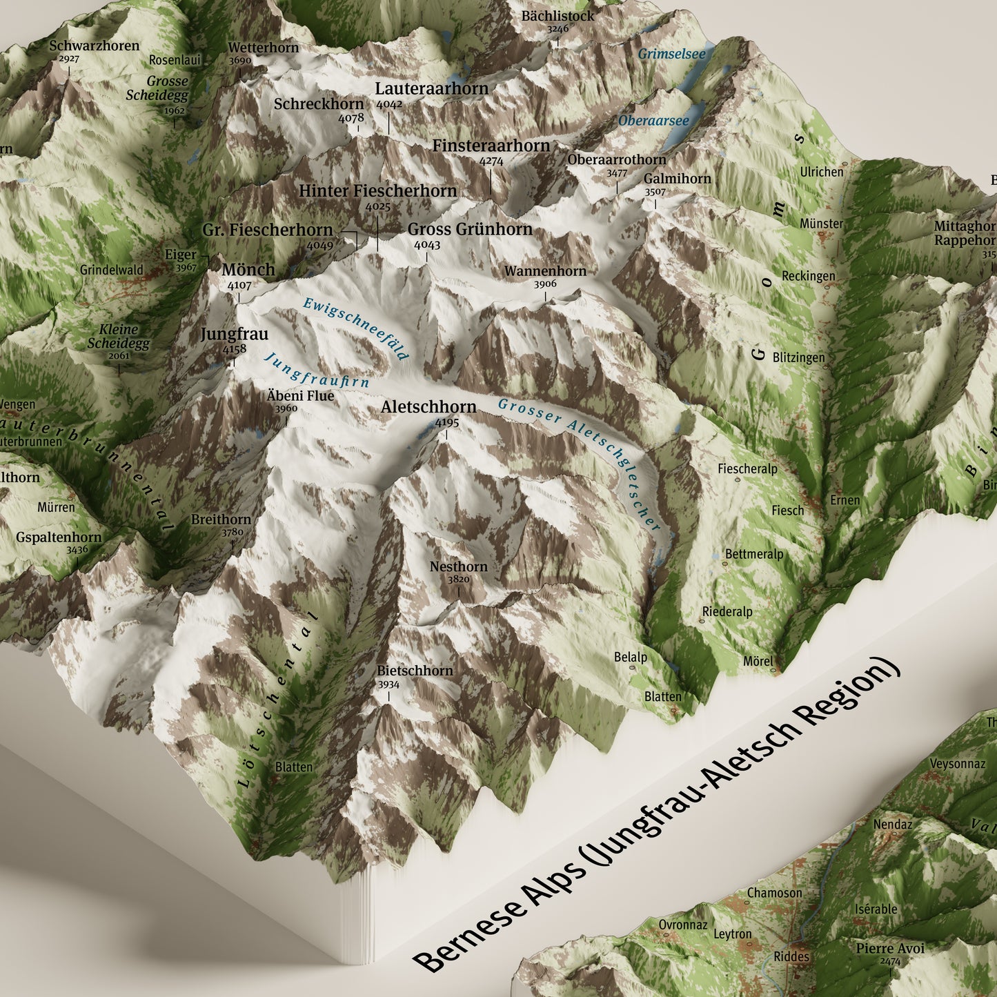
Six panoramic maps side by side portray the Mont Blanc massif, the Pennine Alps with Monte Rosa and the Matterhorn, the Bernese Alps, the Écrins massif, the Gran Paradiso and the Bernina group. An index map at the bottom places each massif within the alpine arc.
Each panel covers a square of roughly 60×60 km — 130×60 km for the Pennine Alps — all sharing the same scale and viewing angle, allowing a direct comparison of the six massifs in terms of extent, relief and overall form.
Rendered in oblique orthographic projection looking from south-west to north-east, it combines cartographic accuracy with visual realism to convey volumes, ridges and glaciers naturally, like a true view over the high mountains.
The result is a faithful and striking three-dimensional image, made for those who love the mountains and want to bring home an overview of the highest peaks of the Alps.
Perfect for:
- Anyone who loves the high mountains and dreams of the great 4000-metre peaks
- Mountaineers and 4000ers collectors who want to keep the entire UIAA list at a glance
- A special gift for anyone who has climbed or dreams of Mont Blanc, Monte Rosa, the Matterhorn or the Gran Paradiso
- Decorating contemporary homes and spaces with a strong yet refined presence, inspired by the great alpine mountains
Print details
- Size: 100×70 cm (39.4×27.6 in)
- Printing: high-resolution offset printing on glossy coated paper, 250 g/m²
- Finish: anti-glare matte lamination, for lasting protection
Available Options
Unframed Map – the map is shipped rolled inside a sturdy protective tube.
Oak Frame Edition – the map is enhanced by a frame featuring a natural oak finish and a clean, understated design, crafted and assembled by hand in Tuscany, Italy.
Unlike traditional framed prints, there is no front glass or acrylic panel. The map surface is protected by a matte lamination that eliminates reflections and allows every cartographic detail to be appreciated with exceptional clarity and natural color rendering.
The map is mounted on a rigid panel with an aluminum core, a professional solution that ensures long-term stability and prevents warping over time.
Each piece is delivered ready to hang.
Shipping
Tracked shipping with email notification. Framed maps are shipped fully insured against loss or damage.
Italy: 2–3 business days · International: 3–5 business days
Created by
This map was personally created with care and passion by Marco Barbieri, cartographer and mountain enthusiast.
More information about cartographic data sources and copyright.
Share