MountainCarto
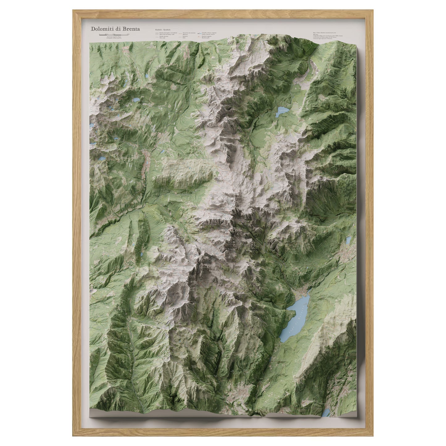
Brenta Dolomites – Panoramic map in oblique projection
Brenta Dolomites – Panoramic map in oblique projection
Couldn't load pickup availability
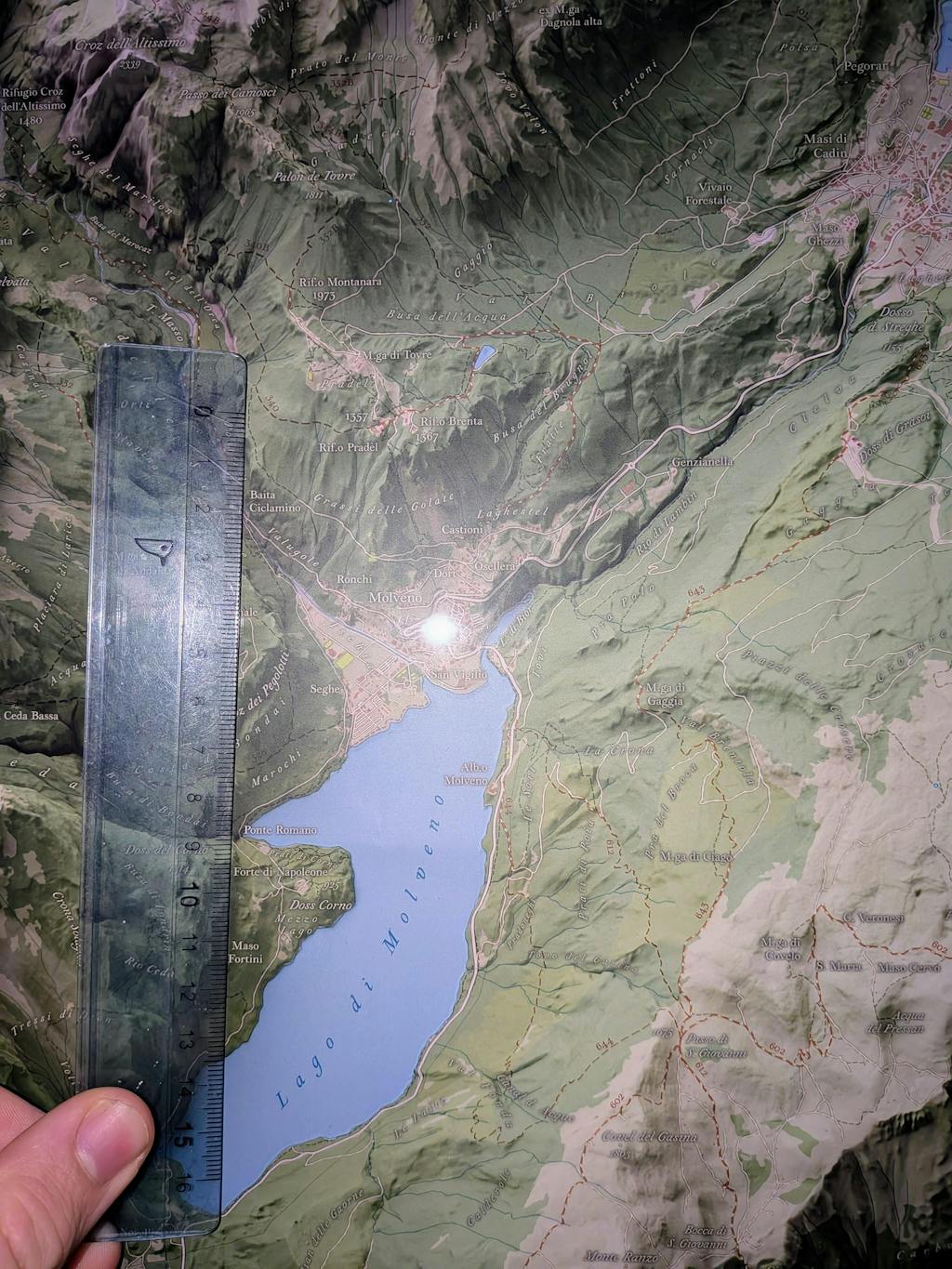
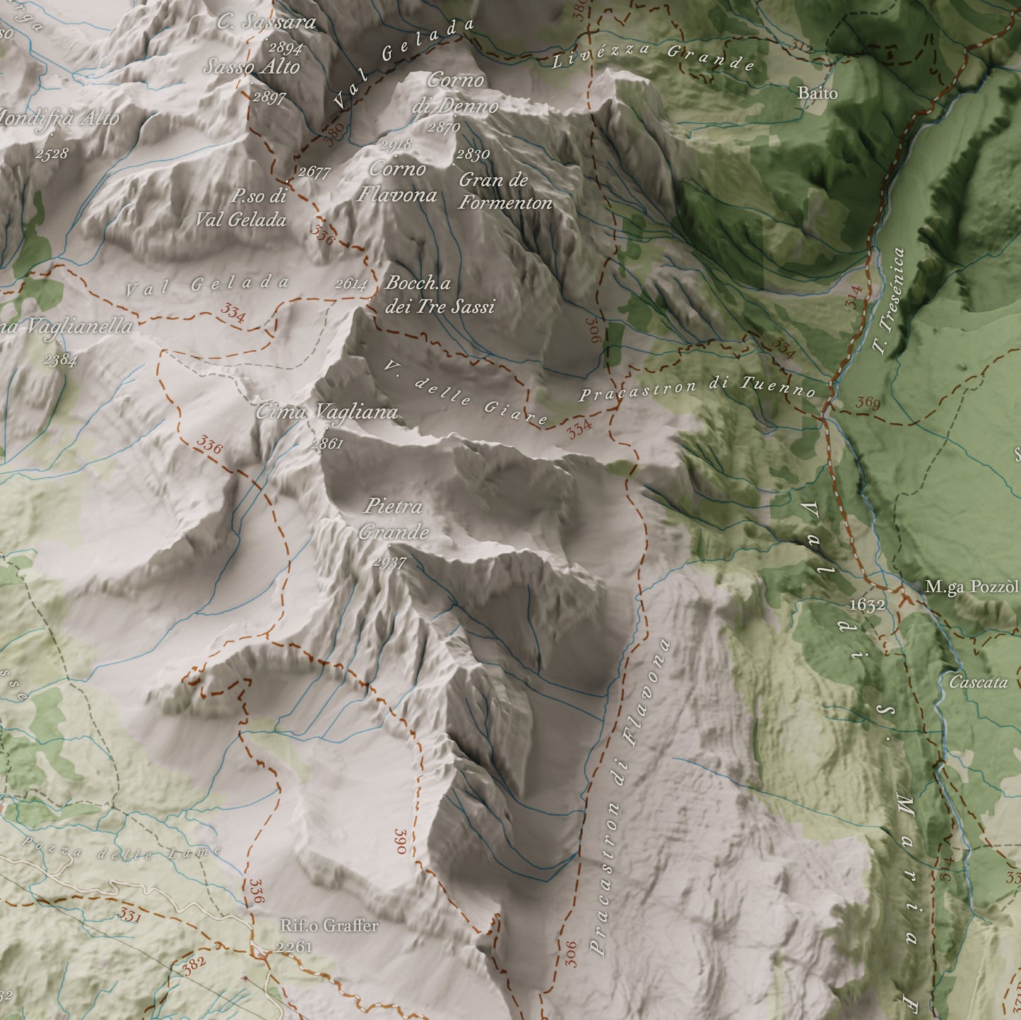
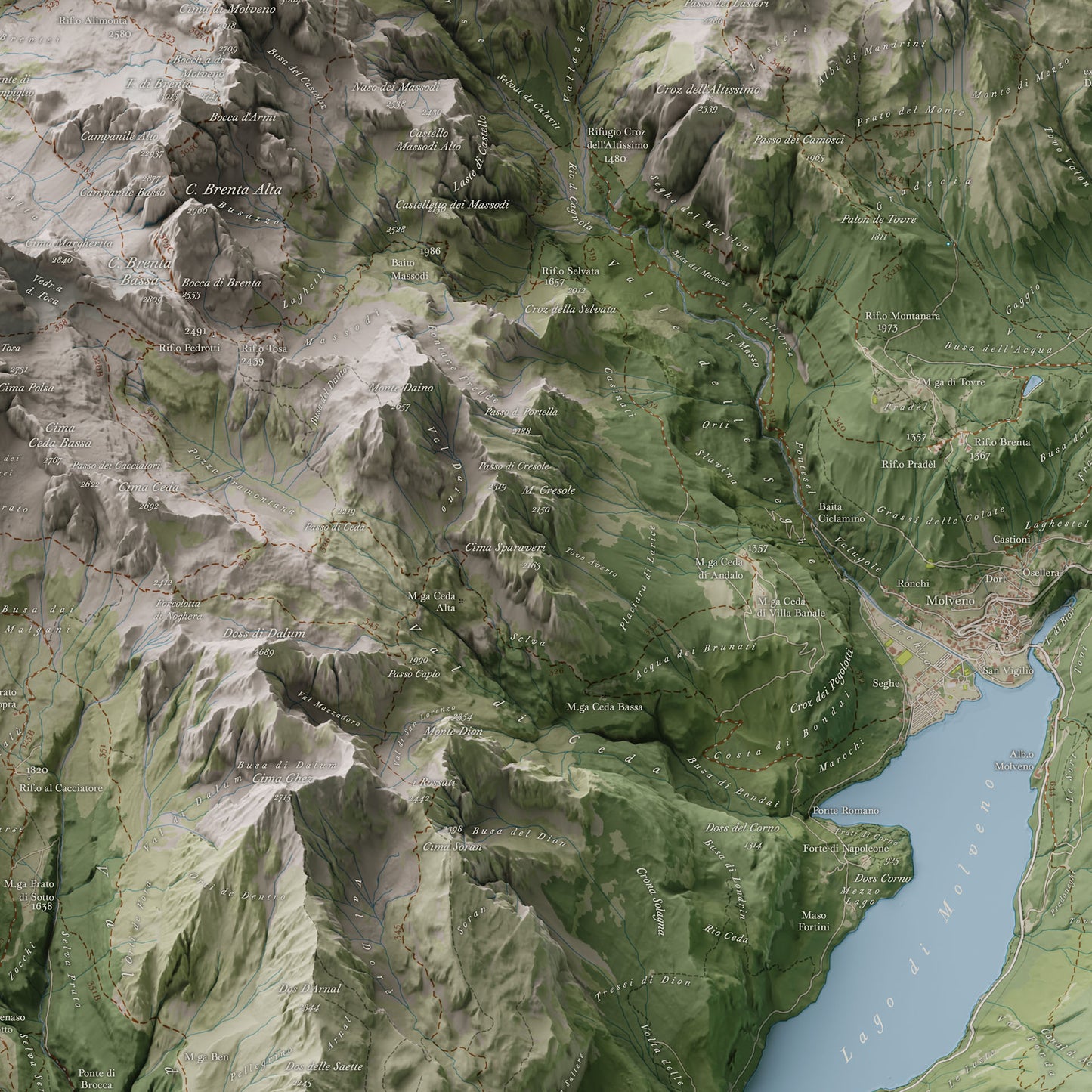
The Brenta Dolomites in a realistic panoramic view
A high-definition representation of the Brenta Dolomites, where ridges, valleys, and plateaus emerge with striking realism thanks to an oblique orthographic projection that renders the mountain relief without perspective distortion.
The map includes the trail network, main alpine huts, and a rich, accurate toponymy: peaks, passes, valleys, plateaus, and inhabited areas are carefully labeled to offer a comprehensive and functional reading of the landscape.
Perfect for
- Hikers, climbers, and enthusiasts of the Brenta Dolomites
- Those who want to plan or remember a route with a beautiful and functional tool
- Decorating lodges, studios, or spaces dedicated to mountains and the outdoors
Printing details
- Size: 70×100 cm
- Technique: High-resolution offset printing on 250 g/m² glossy coated paper
- Finish: Matte anti-glare lamination for long-lasting protection
Available Options
Unframed Map – the map is shipped rolled inside a sturdy protective tube.
Oak Frame Edition – the map is enhanced by a frame featuring a natural oak finish and a clean, understated design, crafted and assembled by hand in Tuscany, Italy.
Unlike traditional framed prints, there is no front glass or acrylic panel. The map surface is protected by a matte lamination that eliminates reflections and allows every cartographic detail to be appreciated with exceptional clarity and natural color rendering.
The map is mounted on a rigid panel with an aluminum core, a professional solution that ensures long-term stability and prevents warping over time.
Each piece is delivered ready to hang.
Shipping
Tracked shipping with email notification. Framed maps are shipped fully insured against loss or damage.
Italy: 1–3 business days ·
International: 3–5 business days
Created by
This map was personally created with care and passion by Marco Barbieri, cartographer and mountain enthusiast.
More information about cartographic data sources and copyright.
Share
Explore the high-resolution map
Beautifully done
Il manifesto è molto bello, ma speravo che fosse davvero in 3D.
Magnifico, vi ringrazio tanto..
Ottimo
la qualità della stampa è perfetta come l'accuratezza della toponomastica. credo si tratti della migliore versione che io abbia mai visto; la proiezione ortografica obliqua rende la mappa veramente bella.
una menzione alla disponibilità, gentilezza e rapidità dell'autore, acquisto super consigliato!